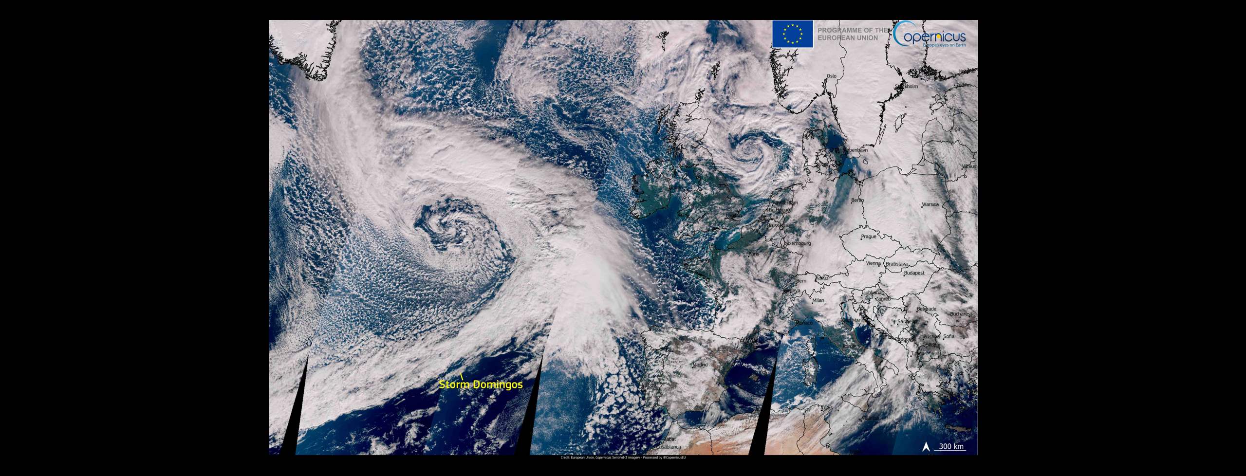
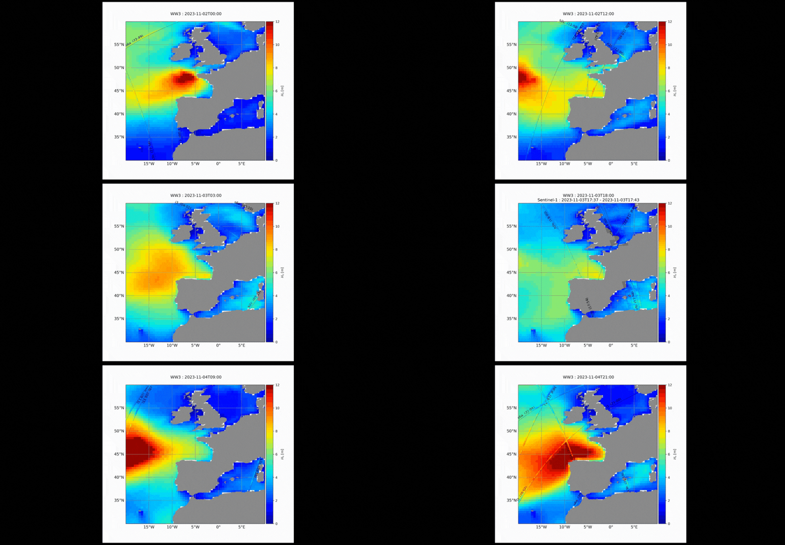
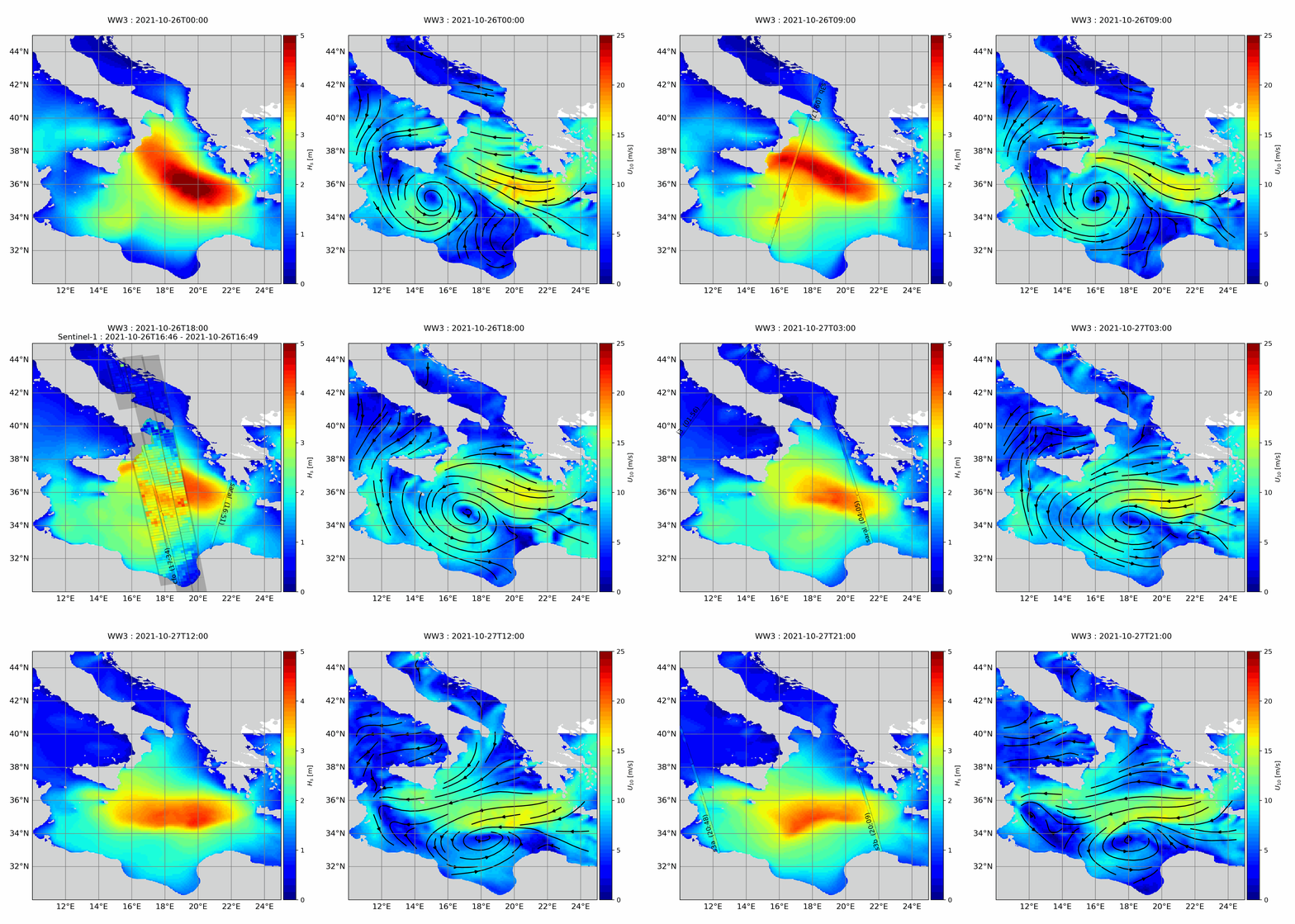
Sentinel-1 IWS TOPS SAR images allow to track storms with precision regardless of the cloud coverage. Synergies with other EO sensors and products can provide a more complete image of their evolution, as it can be seen in this maps of storms Ciaran and Domingos (2023), and Medicane Apollo (2021).
Storms Ciaran and Domingos
Storms Ciarán and Domingos affected several European countries on autumn 2023.

Evolution of storms Ciaran and Domingos over the European Northwestern coast on the 2nd, 3rd, and 4th of November 2023.

Medicane Apollo
Medicane Apollo was a powerful Mediterranean tropical-like cyclone that affected many countries on the Mediterranean coast, especially Italy, in 2021. This image from 27th October 2021 shows Apollo medicane forming over the south of Sicily, with winds of over 100km/h blowing around its centre.

Source: Copernicus Sentinel-3 data 2021.
Evolution of medicane Apollo over the Mediterranean on the 26th and the 27th of October 2021.

Source: Sentinel-1 IWS TOPS SAR images are combined altimeters from 5 different missions (SARAL, MTG-I3, S3, CS2, b2b, CFO) over IFREMER’s WaveWatch III (WW3) model in the background.